
For landowners and farmers
Your green land can be assessed like a new harvest.
Pasture, cropland, forest or land to restore: in some cases, a carbon project can bring in extra revenue. The first conversation doesn’t sell your land or promise income. It’s about understanding whether there’s a path that makes sense.



How we look at your land
First, we look at the whole farm.
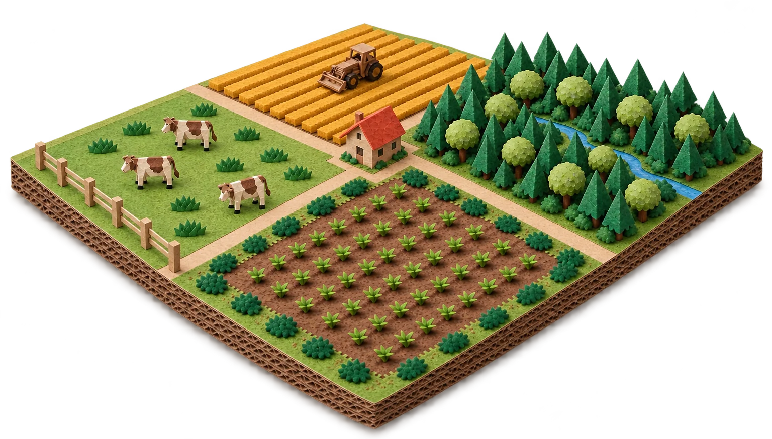
We start with the total area and how it’s split today. Each part has a different story — and that’s where the origin of any credit begins, for whoever owns the land and whoever buys.
- 1
Cropland
Area used for growing crops.
- 2
Pasture
Area used for raising livestock.
- 3
Recovering
A stretch where the soil or vegetation needs to recover.
- 4
Preserved vegetation
Area kept under native vegetation.
Dashed line: illustrative property boundary
Every part needs analysis. None of these areas generates credits automatically.
Illustrative diagram, not to scale and without percentages. It doesn’t represent a real property.
The starting point
Caring for land costs money. The question is whether that care can be recognised.


Today
- Fencing, patrolling and preventing fires
- Protecting springs and riverbanks
- Keeping protected areas, such as Brazil’s Legal Reserve
- Time, labour and inputs that don’t show up when the harvest is sold
With a project, if the analysis confirms it
- A concrete activity (better management, restoration or conservation)
- Measurement and records that prove the result
- Verification by an independent body
- Credits issued and sold, with the split agreed in the contract
Important: having forest, cattle or soy doesn’t automatically generate credits. A credit depends on a project activity, a recognised methodology and verification.
Who does what
Everyone has a clear role.

You
Know the land, share information and documents, allow visits and decide whether to go ahead.
Carbomint
Organises the process, explains every step, coordinates specialists and looks for buyers.
Specialists
Qualified professionals review the technical, environmental and legal side of the property.
Independent verifier
An external body checks the results. Carbomint doesn’t approve its own numbers.
Buyer
A company buys the credits once they’ve been issued and registered.
The partnership
What we ask and what you get.
What we need from you
The land and the care.
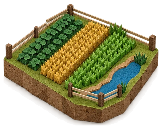
- Land you own or manage — a farm, a forest, a stretch of pasture.
- Willingness to keep it greener over time.
- Access for the team to visit, measure and verify.
- A signed partnership agreement, in plain language.
What you get from us
Clarity, organisation and a partner.
- Every step explained upfront, with the full numbers in the proposal.
- Measurement, verification and registration organised with specialists.
- Help finding the right buyer — we sell the credits together with you.
- A real person, in the field, on the phone and by email.
Everything in plain language
Contracts written like a conversation, not a maze. If you don’t understand a clause, we rewrite it.
You stay the owner
The land is yours. The trees are yours. We only sell verified carbon — together with you.
For the first conversation
It helps to have on hand: location, approximate size, how the land is used today and, if available, land title, maps and (in Brazil) the CAR registry.
Steps
Five steps before any commitment.
These are steps 1 and 2 of the full cycle (getting to know the farm and preparing the partnership), in detail. You can stop at any of them. We only go ahead if there’s a technical and economic path that makes sense for you.
1Get to know the property
Conversation and visit: how the land is used today and what you’d like to change.
2Put together the map and history
Boundaries, land use over the years, documents and records that already exist.
3Analyse the route
With qualified professionals, we check whether an applicable methodology exists and what it requires.
4Weigh costs and commitments
How much it costs to develop, how long it takes and what needs to be maintained on the land.
5Decide together
If it makes sense, everything goes into a plain-language contract. If not, you keep the assessment.
Revenue split
How revenue can be split.
Revenue only exists once credits are issued and sold. Project costs come out of it, and the rest is split according to the contract.
We don’t publish percentages, amounts or timelines before we know the property, the technical route and the real costs. When there’s a proposal, it will show the full numbers, line by line.
1. Sale of issued credits
Price and volume depend on the project, the verification and the market.
2. Project costs
Studies, measurement, verification, registration and whatever else the methodology requires.
3. Split agreed in the contract
Illustration not to real proportion. The split is set in writing, case by case.
Frequently asked questions
What landowners usually ask.
I already keep a Legal Reserve and protected areas (APP). Is that worth credits already?
Not automatically. Brazil’s Law 15.042/2024 recognises that restoring, maintaining and conserving these areas can generate credits, but the project still has to meet the methodology’s requirements and be verified. A legal environmental obligation isn’t the same as an issued credit.
Is the Legal Reserve always 20%?
No. Under the general rule of Brazil’s Forest Code it varies: 80% in forest areas of the Legal Amazon, 35% in cerrado in the Legal Amazon, 20% in grasslands in the Legal Amazon and 20% in other regions. There are exceptions, and each property must be analysed.
Source: Brazilian Forest Code, art. 12
Does the CAR prove the land is mine?
No. The CAR (Rural Environmental Registry) is an environmental record, not a title of ownership or possession. In a project, ownership and possession are analysed separately.
I have cattle or crops. Can I take part?
There may be paths linked to changes in how pasture, soil and crops are managed. But there’s no credit just for having cattle or planting soy: it takes a real change, measured and verified.
Example methodology: Verra VM0042. For restoration: Verra VM0047.
Will I lose the land or the right to use it?
The land stays yours. What changes are commitments on the project areas, such as keeping or restoring vegetation for a period. All of this is explained beforehand and put in writing in the contract.
How much will I earn, and how soon?
Nobody serious can answer that before the analysis. It depends on the area, the technical route, the costs, the verification and the market. Carbon projects usually take years. At step 4, you get an estimate with explicit assumptions.
Monitoring
Once it starts, the project needs to be monitored.
A credit requires proof. That’s why monitoring combines different sources, depending on what the methodology asks for.
- Satellite imagery to track the area’s cover over time.
- Visits and field records to check on site what imagery can’t show.
- Independent verification, periodically, before any credits are issued.
We describe how monitoring usually works. The tools used in each project are defined with the specialists.
Want to know whether your land has a path?
Tell us where it is, its approximate size and how the land is used today. We’ll reply with the next steps.